Showing posts with label DePue. Show all posts

The 1753 - 1845 Boundary Line Records of Sussex & Warren Counties


Tucked away in the Sussex County Divisions of Land, Vol. B, is a complete set of extracts, dated 1753 through 1845, pertaining to the county divisions and precinct (township) partition records. Headings in elegant calligraphy set these pages apart from the preceding mid-19th century court business written in the every day hand of William L. Smith, then the elected County Clerk.  This compilation of material appears to be the last official act of Smith, who served five years in that position, for subsequent entries in Vol. B are in the handwriting of  his successor, Thomas I. Ludlum, elected in 1851.


"Records Relating to the Division of the County of Morris into two Counties, the Division of The County of Sussex into Precincts or Townships & also the Division of The County of Sussex into two Counties, Sussex & Warren, and Subsequently Division of the Townships in the County of Sussex" - Sussex Divisions of Land, Vol. B, p 418.


Sussex Centennary, 1853


While no context is given for this insertion into the record, Smith's intention may have been to gather together, for his successor's ease of reference, the history and particulars of boundary lines as they might relate to the future divisions of estate lands in Sussex County.  The footnoted extracts appear to be accurate facsimiles* of earlier publications, attesting to the meticulous efforts required of a county clerk.  


Another possible motivation for William Smith's work at the time may have been the first preparations underway for the Sussex County 1853 centennial celebration, for both Edsall's and Tuttle's addresses would be heavily footnoted, echoing the Smith compilation as well as earlier histories. Benjamin Edsell's foreword states he is "especially indebted to Thomas I. Ludlum, Esq., clerk of Sussex County, for giving me free access to the books and papers of his office."


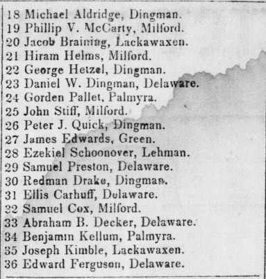
Most interesting to this researcher in the Smith boundary line extracts are the various precinct signatories' full names, the place names within the landscape, and the occasionally noted location of freeholders' homes, including those of Warren County, set off from Sussex in 1824.  Though scattered throughout the 19th century histories, finding such material in one place is a delightful convenience. 


Mansfield Woodhouse Precinct, now Warren County, in 1754.


Partition line Between Sandiston and Montague August term 1801.
 In pursuance of a commission from the judges of the Inferior Court of Common Pleas of May term last we the subscribers met at the house of Daniel Ennis on the 11th day of August 1801, agreeable to notice given and proceeded to run the following line Beginning at the Delaware River at the mouth of Abraham Westfalls Mill Brook near the lower end of Minisink Island ....  (Note the place name Abraham Westfalls Mill Brook is labeled White Kill in the earlier NJ - NY boundary map of 1769.)


White Kill (1769) later known as Abraham Westfall's Mill Brook (1801).


Householders and place names
1753 -1759: Great Pond (Lake Hopatcong), Japhet Byram, Henry Hughe, Ephraim Darby, Ash or Ask Swamp, Ebenezer Byram, David Luse or Leese, Thomas C Cove____,  Henry____, Benjamin Smith, William Schooley, Johannes [John] Depue, Johannis Cornelius Westbrook, Joseph Hull, Richard Gardiner, Richard Lundy, Gap of Packhoquarry Mountain commonly called the Water Gap, Minisink Mountain, Elijah Cole, Joseph Dennis, Hunter's Ferry, Redmund's land, Thomas Scott, Joseph Hixon, Thomas Thatcher, John Richey, mine hill, Col. Stout, young Samuel Green,  Bev___ Pond, Polly P__ Meadow, E___ Harris, Mott's Saw Mill, Edward ___'s Meadow, Ayers, Daniel Westfall, Jerimiah Kittle, Station Point, Col. John Leward, Francis Bernard, Esq. (Governor).

1782-1801:  Spruce Bank (a turn in the Pequest river), Jesse Force, Pepocottin bridge, White Pond,  red Meeting house on the Wallkill, Nathan White, Herman Millhaus, Daniel Ennis, Abraham Westfall's Mill Brook, White Rocks, ___ Decker, George Backster, Joseph Sharp, Jacob Ayres, White's Tavern, Aaron Prall, George Armstrong, Robert C Thompsen, ___ J. Reading.

1824 - 1829: Hardwick church (situated on the South side of the main road leading from Johnsonburg to Newton), John Lawrence, East & West Jersey line, Blue mountain, Nathaniel __axton, Thomas Gorden, Benjamin McCurry,  John Clay, Obadiah Pellet, Beemers Meeting house, Deckertown Church or Meeting house.

1840 - 1845: Joseph Linn (surveyor), Richard R Morris, Thomas A. Dildine, Robert Van Kirk, Benjamin Chamberlain, Robert Mills, Holloway Bates,  heirs of John Ruttenford, Jonah Howell's Mill, Thomas house, Merritt Pinckney, Joseph Northrup, Solomon Roe, Peter G Demerest, Moses Woodruff, A. Boyles, John Snyder, James L. Hunt, William Martin, Seely Pow___, Lewis Sherman. 

Note:  Some people and place names carry through across the years and are repeated in bordering township lines.  Initialed stone boundary markers and variants of the main branches of the watershed have not been included.   

Warren County Addendum
In 1839, under an act of the New Jersey Legislature, Warren County commissioners would set off Hope, Franklin and Harmony Townships.  The recorded survey points of reference include numerous householder locations and place names within the landscape.

Warren County Townships, 1839.
      
1839:  William Tinsman, William Hawke, Joseph Coate, Z___Everitt, Anthony Kirkhoff, Taylor's Tavern, Anthony B Robeson,  County Poor House, Bloomsbury bridge, George Taylor, Merril's Brook, Brass Castle stream, William Runkle (Runkle's bridge), DeWitt's school house, John Stryker, Robinson's Rift (in the Delaware River), Doc'r Jabez Guiness, C__H. Valentine, Edward  Swayze, John VanKirk.


 ~~~~~

* Footnotes within the extracts:

'Allison' refers to the Samuel Allison edition of  Acts of the General Assembly of the Province of New-Jersey : from the surrender of the government to Queen Anne, on the 17th day of April, in the year of our Lord 1702, to the 14th day of January 1776 http://hdl.handle.net/2027/mdp.35112203945466

'Paterson' refers to  Laws of the State of New Jersey, revised and published under the authority of the Legislature, by William Paterson,1800,  http://hdl.handle.net/2027/mdp.35112203945474

Pike County Jury List, February Term, 1842


Jeffersonian Republican, Stroudsburg, Pa., 02 Feb. 1842.
Chronicling America: Historic American Newspapers, Library of Congress


The Ulster County Migrants into the Minisink, 1716

It's always a treat to discover original document film available online, in this case references to the earliest immigration into the Minisink.  Herein eight pages of records with accompanying transcription of the residents, including the Neighborhood of the Neversink River valley (present day Orange County). Numerous family members of those found in the Ulster County records would settle as far south as the Flatbrook & Bushkill confluences with the Delaware River before 1737:

 Tax Assessment List for the County of Ulster, 1716/7

The Freeholders Inhabitants Resident and Sojourners in the County of Ulster theire Reale and Psonall Estates are rated and assessed by the assessor (on theire Oaths) Chosen for the same and that on the 23d day of January in the third yeare of his Majesties Reigne Anno Dom 1716/7 viz+. . . .


Neighbourhood of Wagachkemeck

Researchers will find Ulster Co heads of household listed in the villages along the roads from Kingston: Towne of Marbletown, includes Cornelia Ennis [Ennes] mother of William Ennes, town clerk of Minisink (Montague Township NJ).

1779 Sauthier Map of Provincial New York [including New Jersey]
Click to enlarge

See also:  Recording the Minisink 1701 - 1738.

Pennsylvania Settlers of the Minisink 1740 - 1751

The Bucks County Warrant Registers found at the Pennsylvania State Archives record an interesting overview of the colonial landowners on the West side of the Delaware River in present day Pike or Monroe Counties. These documents often named neighboring grant holders and additional lands held as well as features within the landscape. 

Note the Warrant Registers frequently refer to the location with the place name Minisink, Minisinks, or Minesincks, citing the original application and warrant, but this would rarely carry over onto the survey. The State's surveys were sometimes commissioned many years after the grant of land and may refer to the township and county of the later period. Present day townships may be jotted in the corner or noted on the reverse of the survey and are also found in the compilation of surveys in the Township Warrantee Maps.

Surname variants may appear on the Application, the Warrant and the Survey. Patentees which differ refer to a later sale or heir to the tract. Acreage listed in the Warrant may differ slightly after the more precise survey was conducted.

Click on the link to see the Register page or Survey.  Highlighted names will open a link to the Family Search Warrants 1734 - 1769 in the Pennsylvania Probate Records. The remaining warrants can be found on Ancestry.com (subscription) under Pennsylvania Land Warrants & Applications. Tract, actual warrant descriptions and place names as cited are in italics, the present day township as found on the Warrantee maps are in parentheses ( ):

10 April 1740, Register, John Van Campen, 100 acres,  Survey Note additional settlers on this Register page include:  John Van Etten (1750), Gilbert Vangarder (1750), Gilbert Vancamp (1750), Cornelius Vanakin (1750.)

2 October 1742, Register, Lenor ( ?) Cuykendall, 188 acres, Survey. Land situate below Walpack Ferry in Smithfield Township. 

24 May 1742,  Register, Samuel DePue, 100 acres, Survey, Minisink, situate on the Bushkill (Lehman Twp.) Note additional Minisink settlers on this Register page include:  Samuel DePuey [DePue] (1738), Moses DePue (1743), Andrew Dingman, (1744 - Delaware Twp), Christopher Denmark (1745 - Delaware Twp.)

30 Nov 1744  Register, Simon Westfall,  Survey  to Cornelius DeWytt [DeWitt] in right of Simon Westfall,122 acres, (Milford/Westfall Twp.)

12 June 1749 Register, Cornelius Dewytt, [Dewitt], 100 acres, Survey, Smithfield, (Westfall Twp.)

Westfall Township Warrantee Map for Cornelius DeWytt [DeWitt] tract of 1749.


4  Mar 1750  Register, Peter Robeson [Robinson], Survey 118 acres, Flemings Valley, Remmonds [Raymondskill] Creek, Minisinks. Peter Robinsonadjoining Brewer Dacker [Broer Decker] and Guisbard [Guisbert or Gilbert] Van Camp (Dingman Twp).

11 Mar 1750  Register, Tunis Middagg, [Middaugh], Survey 91 acres, Upper Smithfield (Milford/Westfall Twp.)

11 Mar 1750  Register, Thomas Quick, Survey 103 acres, above the Minesinks (Milford Twp.)

11 Mar 1750  RegisterJohn Williams, Survey 63 acres, Upper Smithfield (Lehman Twp)

13 Dec 1750  Register, James McCarty, Survey, 50 acres, at the Minesincks (Milford Twp.)


20 Dec 1750  Register, Anthony Bunscotta, Survey, 45 acres, Minisink (Lehman Twp.)

20 Dec 1750  Register, Henry J Cortrach [Cortright], Survey, 12 acres, Upper Smithfield (Dingman Twp.)

20 Dec 1750  Register, Brewer [Broer] Decker, 100 acres, multiple surveys, Minisincks (Lehman/Delaware Twp.)

20 Dec 1750  Register, Andrew Dingman, 30 acres, SurveyMinisincks (Delaware Twp.) 

20 Dec 1750  Register, Herman Rosencrans, Survey, 62 acres, Minisinks (Westfall Township)


21 May 1751 Register, Garret Brink, Survey, 54 acres, Brinks Creek, at the Minesinks (Delaware Twp.)         


The PA State Archives' Warrantees of Land in the Several Counties of the State of Pennsylvania, 1730-1898, edited by William Henry Egle, 1898, also lists Bucks County Warrants, arranged by first initial of the surname (variants), then date.


Each of the Surveys cited in this article can be found on the Warrantee Maps, present day townships:

Pike County Township Warrantee maps, Pennsylvania Historic & Museum Commission 
Wayne County Township Warrantee maps, Pennsylvania Historic & Museum Commission 
Monroe County Township Warrantee maps, Pennsylvania Historic & Museum Commission
Bucks County was one of the original Pennsylvania counties formed on 10 March 1682; Northampton Co set off from Bucks County 14 October 1751; Wayne Co set off from Northampton Co 21 May 1798; Pike Co set off from Wayne Co 26 March 1814; Monroe Co set off from Pike and Northampton Counties 1 April 1836.

 See also MVG's collection Historical Maps of the Minisink 1755 - 1875.

UPDATE:  An automated, fully-word-searchable transcription of the Northampton County Warrant Register, transcribed by volunteer Marie Robinson, is now available online.

An excerpt from the quite useful Land Records Guide of the Historical Society of Pennsylvania:

 "...During William Penn’s proprietorship, much of the land settlement was never recorded formally so squatting on land was common practice. Land that had been settled under this policy was considered improved land. All other lands vacant were considered unimproved lands. In order to regulate the settling of their lands and to retrieve payment from squatters who settled before 1754, the Penns [heirs of William] further updated the application system, which consisted of a series of documents including application, warrant, survey, and patent...."

Disputes over Warrants may be found in Minutes of the Board of Property and Other References to Land in Pennsylvania including Proprietary (Old) Rights; Pennsylvania Archives, Vol II, Harrisburg, 1894.

1766 Applications for Warrant

Identified place names:
Deckers Creek - present day Hornsbeck Creek
Remmonds or Rimmonds Creek - present day Raymondskill Creek
Swartwood Creek or Swartwoods Mill Creek - present day Toms Creek

Unidentified place names:
Brink's Creek - ?

UPDATE:  Pennsylvania Residents have FREE access to PA Land Records on Ancestry providing they also have a free Ancestry account: Click the PA State Portal page for more information. 

1874 Beers Map of the Old Mine Road, Pahaquarry Twp, Warren Co NJ

It's always a treat to explore a Beers map of the 19th century.  This example details the Old Mine Road running through Pahaquarry Township with an insert of the village of Millbrook. Numerous ferries, old mine holes, limekilns, springs, hotels, schools, quarries and mineral deposits are shown.  Landowner surnames include:  Berke, Bruen, Bunnell, Courtright, DePue, Dietrick, Fisher, Garis, Hetzel, Hill, Howell, Kimble, LaBar, Michael, Morris, Oakes, Oxenbough, Ribble, Rinehart, Shoemaker, Spangenburg, Struck, Tillman, Transue, Trauger, Van Campen, Van Gorden, Walleer, Warner, Welter, and Zimmerman.  Original data microfilmed by the Library of Congress, Washington, D.C.:  County Atlas of Warren New Jersey, F W Beers & Co, 1874.   


Click to enlarge & zoom into the map here.
Two existing cemeteries  are shown in the upper right hand corner, Calno P.O. district. 


The DePue family burying ground surnames:   Barry, Depue, Kinney, Trauger

Above, Depuy burying ground; below Van Campen burying ground.


The Calno - Van Campen burying ground surnames:   Bunnel, Cole, Depue, Gariss, Hawkins, Henry, Kimble, Kirkhuff, Michael, Mitchel, Oaks, O'Brien, Ozenbaugh [Oxenbough?], Reamer, Ribble, Shoemaker, Sitgreaves, Spangenberg, Stires, Stoddart, Sutton, Van Campen,  Williamson.

The Moses Van Campen House - Heir "B B Van Campen" on the 1874 map

Locations of the DePue & Van Campen burying grounds, Col. Abraham Van Campen & Moses Van Campen houses:


View Minisink Valley Genealogy in a larger map


Drawn by Jacob Hoffman, engraved by John Scoles, New York Magazine, February, 1794, Library of Congress

Samuel Preston's Account of River Floods, 1800 & 1814

Samuel Preston settled in Stockport, Wayne County PA in 1788.  His account of a supposed periodic cycle of flooding of the upper Delaware River is priceless for its detailed observations on farming in the valley.  Fellow farmers and informants he references are:  John Hilborn, on the Susquehanna, Nicholas Depui, Esq. of Minesink [Monroe Co PA], Joseph Ross of Cosheckton [Cochecton NY] and Erasmus Darwin, grandfather of Charles Darwin.  The work first appeared in  Memoirs of the Philadelphia Society for Promoting Agriculture: Containing Communications on Various Subjects in Husbandry & Rural Affairs, Volume 4, 1818.

Additionally:
John Linchlaen's 1791 journal entry of his visit to Samuel Preston's farm in Stockport.
Samuel Preston. On clearing land, New England Farmer, 9 January 1829, midway 2nd column.
Samuel Preston, Gardening of the Germans in Pennsylvania, The Farmer's Cabinet, 1836, p 52.


Note the term cheat in this letter may refer to to the weed Cheat (Bromus secalinus) or perhaps, weeds in general.


Deciphering the 1830 Ennes - Westbrook bill for $2.13

While paging through the Ennes / Ennis family file at the Pike Co Historical Society I found the following original clipping from an old ledger found in the attic of a Tocks Island condemned building at Dingmans Ferry in Pike Co some years ago.  Said ledger clippings are distributed throughout the various holdings of family files at the Society and are available for copying, though the pages before and after the entry are, in consequence, a mystery.


click on the document to enlarge

1st line reads: Joseph Ennes  ?__  (an abbreviation?)
2nd line:  __ Solomon Westbrook ___ (Sr. or Dr.?)
3rd line: 1830
Subsequent lines by date:
June 2 + 3 __o 8 1/2 gills Brandy ?__-- $0.50
              4   "    3       gills Brandy 1/  --   0.37 1/2  
              5   "    1       gill       "      1/  --   0.12 1/2
              8   "    2       gills    Gin    1/ --    0.25
and so forth down to
July  14      "     2   cocktales ?       ?        0.12 1/2

for a total of $2.13, which is correct.

Now the questions are who is serving whom and what are the abbreviations:
Was Joseph Ennes the bar keeper or was Solomon Westbrook?
Is the word after Ennes Jr?
Is the word before Solomon To? And is that word repeated in the bill before 8 1/2 gills of Brandy on June 2 + 3?
And, finally, could the ledger keeper / barkeeper have meant cocktails for cocktales?

There was no Joseph Junior to the best of my knowledge and NJ Index of Wills Vol III lists a probate Inventory for Joseph Ennes in the year 1830.  He is known to have worked as a ferryman and to have kept a public house for the raftmen on the Jersey side of the river.

Wiki - The gill (pronounced[1] /ˈdʒɪl/) is a unit of measurement for volume equal to a quarter of a pint.[2] It is no longer in common use, except in regard to the volume of alcoholic spirits measures, but it is kept alive by the occasional reference...

UPDATE:
Definition of COCKTAIL
1
a : an iced drink of wine or distilled liquor mixed with flavoring ingredients
b : something resembling or suggesting such a drink as being a mixture of often diverse elements or ingredients
c : a mixture of agents usually in solution that is taken or used together especially for medical treatment or diagnosis
2
: an appetizer served as a first course at a meal


Origin of COCKTAIL
probably from 1cock + tail
First Known Use: 1806


UPDATE:
Thank you dear readers for your helpful responses to the questions posed in  Deciphering the 1830 Ennes - Westbrook Bill for $2.13. Quite useful was this supplied link to How to Read 18th Century British American Writing.

A summary of  the responses, my thoughts & additional research:

  • Solomon Westbrook is most certainly the bar / store keeper and the preceding word, carried down throughout the bill being To.  A quick visit to the Society and examination of another family file with clipping from the same ledger confirms Solomon Westbrook's record keeping in the 1830s.  Said records cover his General Store's worth of goods from barrels of dried apples & bushels of wheat to pins & fabric. 
  • On the abbreviation following Westbrook it was pointed out: When researching early accounting methods, which were handwritten, it was noticed that the terms “Debit” and “Credit” were sometimes written as “Dr.” and “Cr.”  See also 18th Century Handwriting Contractions, Dr in superscript for debtor.
  • The question of the word following Joseph Ennes, which might be Jun in superscript, remains open. As was noted by a reader, the letter J following Ennes is not formed as in June & July in the clipping, however the top half is a duplicate of that in June & July.... with less room for the J's tail flourish accounting for the difference perhaps? And (this is most interesting) per Index of Terms used in 17th Century Wills and Inventories, if it is a Jur not Jun,  the word might indicate juramento (abbreviated form 'Jur') which is latin - by the oath of. This seems quite logical - Joseph Ennes, Jur swears on oath To Solomon Westbrook (note the space) to honor as Dr. debtor the following ... How this might relate to the probate of old Joseph in 1830 is still a question.
 Multiple sources, as supplied by our readers, noted the origins of the word cocktail including this quite interesting quasi-medicinal version:   H.L. Mencken lists seven versions of its origin, perhaps the most persuasive is Fr. coquetier "egg-cup." In New Orleans, c.1795, Antoine Amédée Peychaud, an apothecary (and inventor of Peychaud bitters) held Masonic social gatherings at his pharmacy, where he mixed brandy toddies with his own bitters and served them in an egg-cup. The drink took the name of the cup, in Eng. cocktay.