 |
| 1775 Montresor & Andrews, detail of Provincial NJ, NY, PA |
REGIONAL MAPS: This collection is chosen for the level of detail specific to the Minisink in Zoom View as surveys and boundaries evolved across time and which include variants of place names, early settlements, forts and in some cases property owners and mills.
- 1755, Lewis Evans, A general map of the middle British colonies, Library of Congress. Later edition, 1771, showing Sussex Co NJ settlements & forts on the west side of the river here.
- 1759, Nicholas Scull, A map of the improved part of the Province of Pennsylvania, Library of Congress.
- 1769, unknown, Three maps of northern New Jersey, with reference to the boundary between New York and New Jersey, Library of Congress. See also: 1769, Ratzer, Bernard. A copy of the general map the most part compiled from the actual survey... the partition line between the provinces of New York and New Jersey; Samuel Holland's 1768? map of the Provinces of New York and New Jersey, Library of Congress.
- 1769, Bernard Ratzer, ...The Partition Line between New York and New Jersey 1769, Houghton Library, Harvard University.
 |
| 1769, Minisink Precinct, Three maps of northern New Jersey |
- 1775, Montresor & Andrews, A map of the Province of New York, with part of Pensilvania and New England, New York Public Library, or here, Library of Congress.
- 1776, Thomas Jefferys, map of The Provinces of New York, and New Jersey; with part of Pensilvania, Rumsey Collection. See also the Jefferys' Atlas map of Pennsylvania.
- 1777, William Faden, after Bernard Ratzer. The Province of New Jersey, divided into East and West, commonly called the Jerseys. Available in a TIFF format.
- 1779, Claude Joseph Sauthier, A chorographical map of the Province of New-York in North America, divided into counties, manors, patents and townships; exhibiting likewise all the private grants of land made and located in that Province [including Northwest NJ], surveyed before 1776, Library of Congress.
- 1780, Thomas Millidge, A map containing part of the Provinces of New York and New Jersey, Library of Congress.
- 1792, Reading Howell, A Map Of The State Of Pennsylvania, Rumsey Collection. Note mill owners are also shown in NJ & NY.
 |
| 1792, Mills in NY NJ PA, Reading Howell, A Map Of The State Of Pennsylvania, |
- 1788, NY Dept of State, Map of the State of New York with its Counties. NYS Digital Collections.
- 1802, Simon De Witt, Map of the State of New York, Library of Congress.
- 1828, Thomas Gordon, A Map of the State of New Jersey With Part of the Adjoining States, Rumsey Collection or Princeton University Library, here, under "First Wall maps and Atlases" scroll down, includes the Thomas Gordon, 1833 edition.
 |
| 1779, Sauthier, A chorographical map of the Province of New-York [including NW New Jersey] |
COUNTY MAPS: This collection is chosen for the level of detail specific to property owners and land grants and which may include industry, businesses, schools, churches, etc.
SUSSEX & WARREN COUNTIES, NEW JERSEY
- 1852, D. McCarty, Map of Warren County, New Jersey, & 1874, F.W. Beers, Princeton University Library.
- 1860 Griffith Morgan Hopkins, Jr., Map of Sussex Co. New Jersey From Actual Surveys & Records, (also showing PA landowners along the River Rd, present day Rt 209, from Bushkill to Matamoras) The Library of Congress.
- 1872, F. W. Beers, Topographical map of Sussex Co. New Jersey, Rumsey Collection, or here, Rutgers Collection.
- 1872, F. W. Beers, Topographical map of Warren Co. New Jersey, Rutgers Collection, or here, Rumsey Collection.
- 19th & 20th c Sanborn Fire Insurance maps for communities in Sussex and Warren Counties (scroll down); detailed maps with factories, hotels, buildings & businesses.
 |
| 1852, D. McCarty, Pahaquarry township, (Scroll down) Map of Warren County |
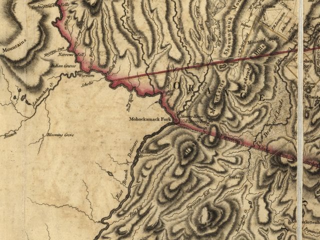
- 1829, David Burr, Map of the counties of Orange and Rockland, Rumsey Collection.
- 1829, David Burr, Map of the County of Sullivan, Rumsey Collection.
- 1875, F.W. Beers, Atlas of Orange County, Hudson River Valley Heritage Collection.
- 1875, F. W. Beers, Atlas of Sullivan County, Hudson River Valley Heritage Collection.
 |
| Barryville, 1875, Beers Atlas of Sullivan County NY |
- 1895, Julius Bien, Sullivan County, Rumsey Collection.
- 1903, A. H. Mueller, Atlas of Orange County, Hudson River Valley Heritage Collection.
- 1908, Historic USGS Port Jervis, NY-NJ-PA Quadrangle, UNH Dimond Library.
- 1814, A map of Wayne & Pike counties, Pennsylvania : shewing the situations & forms of the warrantee tracts, Jason Torrey, Library of Congress. In addition, key to the Torrey map Names of the Original Warrantees of Pike Co., PA, Rootsweb.
- 19th & 20th c Sanborn Fire Insurance maps for communities in Monroe, Pike & Wayne Counties; detailed maps with factories, hotels, buildings & businesses. Penn State Libraries.
- 1860 Hopkins' Map of Wayne Co., Library of Congress.
- 1860 Walling, Map of the Counties of Monroe & Carbon PA, Library of Congress.
- 1872, F. W. Beers, Topographical Map of Pike Co., Pennsylvania Historic & Museum Commission or here, Library of Congress
 |
| Detail of the 1872 Beers Topographical Map of Pike Co PA |
- Coolbaugh A Index, Coolbaugh B Map
- Blooming Grove, Delaware, Dingman, Greene, Lackawaxen (North), Lackawaxen (South), Lehman, Milford, Palmyra, Porter, Shohola, Westfall.
- Berlin, Buckingham, Canaan, Cherry Ridge, Clinton, Damascus, Dreher, Dyberry, Lake, Lebanon, Lehigh, Manchester, Mount Pleasant, Oregon, Palmyra, Paupack, Preston, Salem, Scott, South Canaan, Sterling, Texas.
 |
| Lehman Township Warrantee Map, Bushkill vicinity. |
The MVG Annotated Google Map of the Minisink Valley, with 18th & 19th century burying grounds and ancestral homes including links to early maps, land warrants, and points of historic & geographic interest, has recently migrated to the new format. Mapped locations of cemeteries and existing historic structures are based on our actual field surveys.
 |
| Annotated Google Map of the Minisink Valley |