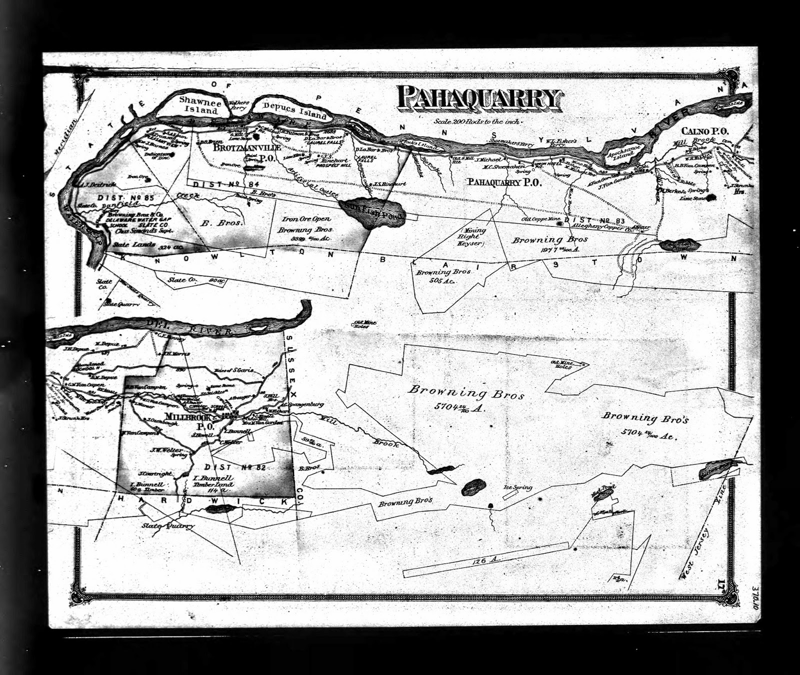
It's always a treat to explore a Beers map of the 19th century. This example details the Old Mine Road running through Pahaquarry Township with an insert of the village of
Millbrook. Numerous ferries, old mine holes, limekilns, springs, hotels, schools, quarries and mineral deposits are shown. Landowner surnames include: Berke, Bruen, Bunnell, Courtright, DePue, Dietrick, Fisher, Garis, Hetzel, Hill, Howell, Kimble, LaBar, Michael, Morris, Oakes, Oxenbough, Ribble, Rinehart, Shoemaker, Spangenburg, Struck, Tillman, Transue, Trauger, Van Campen, Van Gorden, Walleer, Warner, Welter, and Zimmerman. Original data microfilmed by the Library of Congress, Washington, D.C.:
County Atlas of Warren New Jersey, F W Beers & Co, 1874.
Click to enlarge & zoom into the map
here.
 |
| Two existing cemeteries are shown in the upper right hand corner, Calno P.O. district. |
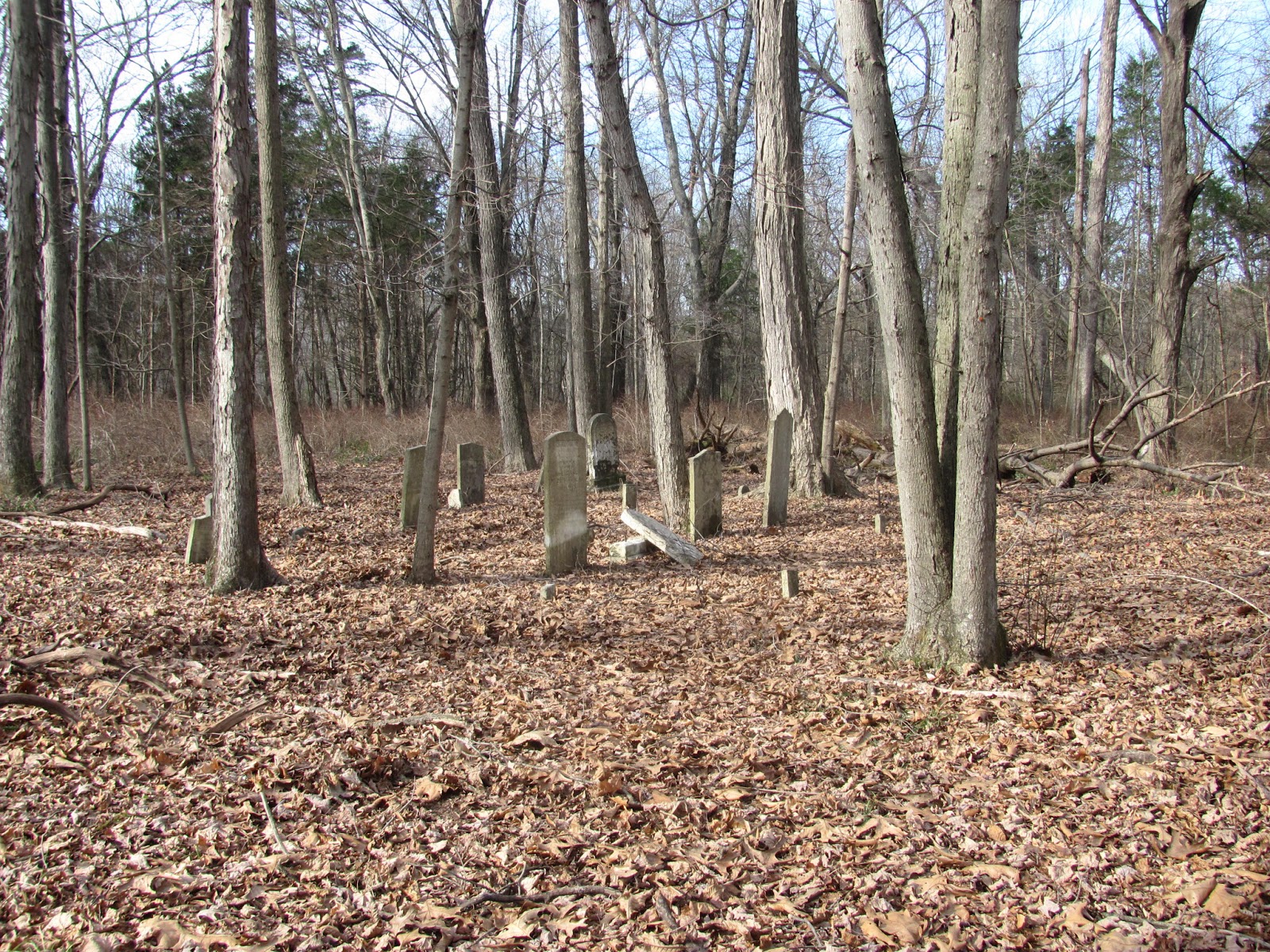 |
| The DePue family burying ground surnames: Barry, Depue, Kinney, Trauger |
 |
| Above, Depuy burying ground; below Van Campen burying ground. |
The Calno - Van Campen burying ground surnames: Bunnel, Cole, Depue, Gariss, Hawkins, Henry, Kimble, Kirkhuff,
Michael, Mitchel, Oaks, O'Brien, Ozenbaugh [Oxenbough?], Reamer, Ribble, Shoemaker,
Sitgreaves, Spangenberg, Stires, Stoddart, Sutton, Van Campen,
Williamson.
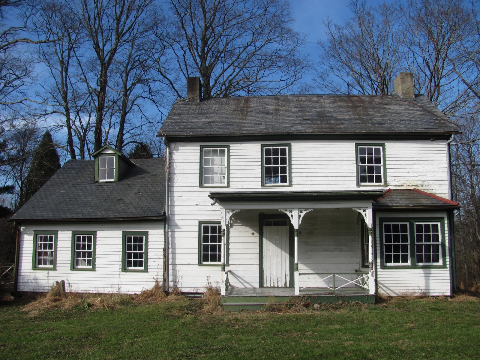 |
| The Moses Van Campen House - Heir "B B Van Campen" on the 1874 map |
Locations of the DePue & Van Campen burying grounds,
Col. Abraham Van Campen &
Moses Van Campen houses:
View Minisink Valley Genealogy in a larger map
 |
| Drawn by Jacob Hoffman, engraved by John Scoles, New York Magazine, February, 1794, Library of Congress |


